(Et si on reparlait de la gestion par les compagnies des eaux privées. Partout où elles ont le monopole les pays prennent feu comme en Australie. note de rené)
Map Shows Wildfire Outbreak Sweeping Across US Amid Megadrought
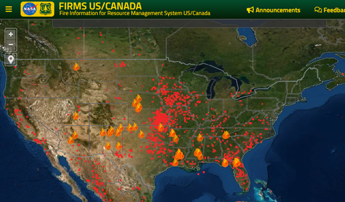
New data from NASA's Fire Information for Resource Management System (FIRMS) shows an outbreak of wildfires sweeping across the country.
FIRMS' interactive map shows wildfire activity is expanding in the country's Southeast, Midwest, and Southwest regions amid one of the worst megadroughts in 1,200 years.
National Interagency Fire Center (NIFC) released an update Wednesday that said more than 3,700 wildland firefighters and personnel are assigned to eleven major fires.
"The Southwest area continues to have the most large fire activity, where five incident management teams are assigned. One complex incident management team is assigned to a large fire in Nebraska," NIFC said.
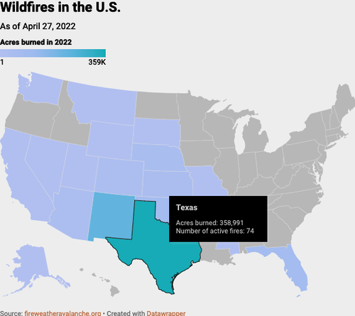
The agency said more than 21,181 wildfires had burned 1,080,836 acres in the US since the beginning of the year. That's above a 10-year average of 14,958 wildfires that burned 727,141 acres. Some of the most devastating wildfires have been in Texas due to "extreme drought" and high winds.
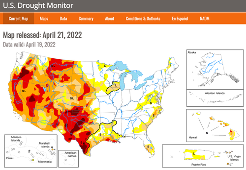
Much of the US West is experiencing severe to extreme drought conditions. The outbreak of fires comes as no surprise.
Recent forecasts by federal government meteorologists may suggest drought conditions could worsen as there's a 59% chance of La Niña for the Northern Hemisphere through summer. What this would mean is drier conditions that could spark even more wildfires.
However, it's the opposite in the Northern Plains, where historic flooding has wiped out farmlands and delayed plantings that could trigger additional global food supply chain problems.
Megadroughts, wildfires, and historic floods are some of the natural disasters plaguing the US.


Aucun commentaire:
Enregistrer un commentaire